Ben Joffe introduced a new equal-area cartographic projection
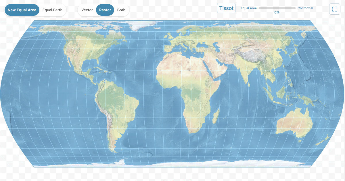
Developer Ben Joffe introduced a mathematical formula for creating interactive maps that provides a smooth transition from equal-area projection to standard Mercator projection when zooming, eliminating visual distortions characteristic of traditional data display methods on web interfaces.
The new projection solves the problem of preserving object areas when zooming, which is particularly noticeable when displaying regions such as Africa, Japan, and Australia. Unlike existing analogs, including Equal Earth, the algorithm automatically recalculates coordinates, ensuring mathematical accuracy when transitioning between levels of detail, avoiding object stretching typical of Mercator projection at high latitudes.
The algorithm implementation is available for integration into modern mapping engines, with the formula minimizing computational costs, allowing for real-time rendering without loss of browser performance. The source code and mathematical description are published on the project's official page, which also features interactive examples of the system's operation.
This development is aimed at creating more accurate geodata visualization tools in web applications, as using equal-area projections in interactive mode has long been limited by the complexity of calculations during dynamic zooming, but the proposed method makes this process native to user interfaces.
Related news
 The study revealed the algorithms of ChatGPT search operation
September 15, 2026
The study revealed the algorithms of ChatGPT search operation
September 15, 2026
 Researchers assessed the level of AI adoption and demand for skills in different countries
September 15, 2026
Researchers assessed the level of AI adoption and demand for skills in different countries
September 15, 2026
 Researchers estimated the share of AI code in F-Droid catalog apps
September 15, 2026
Mathematicians proved the k-server hypothesis
September 15, 2026
Researchers estimated the share of AI code in F-Droid catalog apps
September 15, 2026
Mathematicians proved the k-server hypothesis
September 15, 2026